
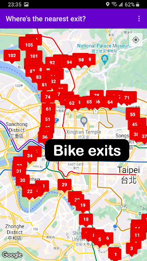
Features Taipei Riverside Bike Exits
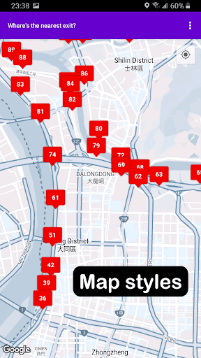
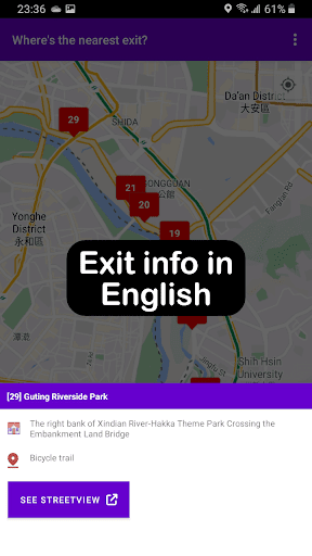
The Taipei Riverside Bike Exits app is a simple app that maps all known exits located along Taipeis riverside bike paths.It offers a limited set of options that you can use to customize the map: + Change map styles and map markers + Switch between EN and ZH descriptions + Link to Google street views + Drop temporary map markersI created this app to help me navigate the long winding bike paths of the Taipei riverside.
There have been multiple times when I would usually encounter roadwork that forces me to look for bike exits where I can get in and out my usual route.
However, you can also use this app for other purposes: + Planning cycling tours or day trips + Looking for alternative biking trails + Finding the optimal bike path for your commute + Scouting out your favorite riverside park + Tourism and travelling Exit data is taken from information published by data.gov.tw.
For more details, navigate to the More information section of the app.
The app uses Google Maps and requires access to your location to determine your current position.
All data is saved locally and remains on your device.
Note that this is my first app and is very much a work in progress.
I detail all known issues, troubleshooting tips, and additional information here:https://bit.ly/TaipeiRiversideBikeExitsThank you for installing Taipei Riverside Bike Exits!
Weather Features
Get accurate weather forecasts and real-time updates.
Travel Features
Plan and manage your travels with ease.
Food & Dining
Discover recipes and order food from your favorite restaurants.
See the Taipei Riverside Bike Exits in Action
Get the App Today
Available for Android 8.0 and above